AGAP-GAMBIT
The Antarctica's Gamburtsev Province (AGAP) Project and the airborne survey component: The Gamburtsev Aerogeophysical Mapping of Bedrock and Ice Targets (GAMBIT) Project
About
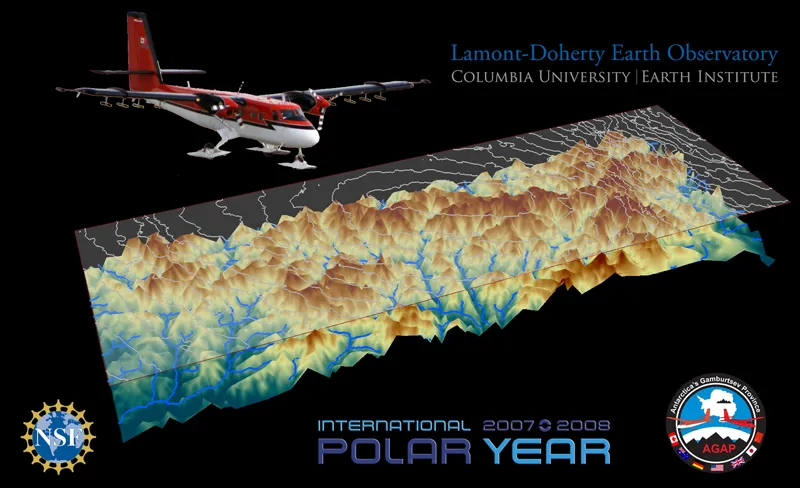
The Antarctic Gamburtsev Province (AGAP) Project was a multinational and multi-disciplinary program with the central focus of studying the Gamburtsev Subglacial Mountains. The Gamburtsev Mountains are as large as the European Alps -- boasting an expanse of 1,200 kilometers (~750 miles) and heights over 3,000 meters (1.8 miles). This massive undertaking is made more difficult by the fact that they sit underneath the East Antarctic Ice Sheet. The ice at ‘Dome A’ (the highest point on the East Antarctic Ice Sheet) is 3,200 meters (~2 miles) thick, and the Gamburtsev Mountains are below it The goal of AGAP was to gather information about: accurately characterizing the mountains’ tectonic origin; the connection between the Gamburtsev Mountains, subglacial lakes, and the overlying ice sheet; and, identifying the location of the oldest Antarctic ice and recovering the oldest climate record.
The airborne component of AGAP was the Gamburtsev Aerogeophysical Mapping of Bedrock and Ice Targets (GAMBIT) Project. While several AGAP surveys included traverse programs, passive seismic experiments, ice core drilling, and bedrock drilling; airborne geophysical surveys are the best, and most cost-effective, method to characterize broad areas of the ice sheet and sub-ice basement. An airborne survey can also provide key support for ice and bedrock drilling efforts. All of the data collected from the AGAP-GAMBIT Project provided crucial new input into ice sheet and climate models.
The Science
Due to a fundamental lack of geological and geophysical data from the deep interior of Antarctica, the AGAP-GAMBIT consortium was determined to shed a light on this vast continent's geological processes. Antarctica's history as a continent began 3,500 million-years-ago, and continues to be tectonically active today. It's geological processes are the driving forces for ice sheet dynamics, which affect the global environment; and furthermore, have an impact on long-term, large-magnitude, sea level and climate changes. As such, the AGAP surveys of Antarctica focused on ice volume, ice internal structure, bedrock elevation, lithology, structure age, and tectonic history.
The survey of the Gamburtsev Subglacial Mountains led to the discovery of liquid water locked deep under the continent's coat of ice. This water regularly thaws and freezes to the bottom of the ice sheet, which actively modifies its structure - thinning the ice by as much as half its thickness in some places. This freeze-on process occurs far below the ice surface, and turns common perceptions of glacial formation completely upside-down. Ice sheets are known to grow from snowfall building up in annual layers on the surface over thousands of years. The subglacial melting discovered here reshaped our understanding of how the Antarctic ice sheet expands, moves, and potentially how it might react to a warming climate.
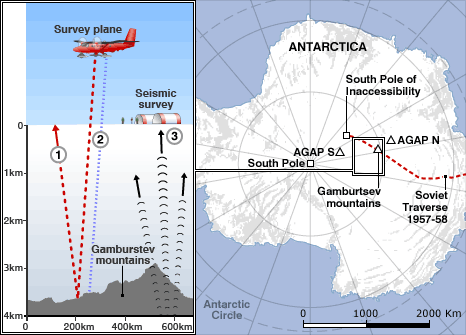
Figure 1. (LEFT) An infographic shows a survey plane flying over the ice sheet covered Gamburtsev Mountains, and arrows showing how signals from remote sensing instruments detect ice thickness and mountain depth. (RIGHT) An image of Antarctica labelled with the locations of the South Pole, Soviet Traverse of 1957-58, AGAP North Camp, AGAP South Camp, and the Gamburtsev Mountains.
The GAMBIT Project focused on the area of ‘Dome A’ in the deep interior of the East Antarctic Ice Sheet. For an area as remote as ‘Dome A’, an airborne geophysical survey was the most efficient method of data collection. The GAMBIT Project surveyed an area roughly the size of Texas, over ‘Dome A’ and the Gamburtsev Subglacial Mountains. There they flew a modified fixed-wing aircraft, which was outfitted with a suite of geophysical instruments. The Twin Otter aircraft, traditionally used by Alaskan bush pilots, carried a gravity meter, a magnetometer, ice penetrating radar, and a laser camera. Using data from all these sensors, we discovered freeze-on ice on the mountains, subglacial lakes trapped beneath the ice sheet, distinct layers within the ice sheet that expressed annual snowfall accumulation, and much more.
The Methodology

Figure 2. The figure above is an infographic showing the methodology of the AGAP-GAMBIT survey over Dome A in Antarctica. The graphic shows the Gamburtsev Mountains beneath the East Antarctic Ice Sheet, and AGAP surveys taking place on the surface of the ice sheet. On the left is a field camp that represents the two main field camps: AGAP North and AGAP South. Above the ice sheet is a Twin Otter Aircraft with blue circles and green dashes emanating from underneath it, and go through the ice sheet to the surface of the Gamburtsev Mountains. The blue circles represent radar waves reflecting back to the aircraft, revealing: ice thickness, ice layering, the location of subglacial lakes, and the shape of the bedrock. The green dashes represent airborne magnetics and gravity measurements, which reveal: details of the subglacial geology, sedimentary basins, tectonic structures, and deep crustal structure. To the right of the Twin Otter, there is a representation of the over 20 seismometers deployed and serviced on the ice for the AGAP survey. Red arrows and parentheses represent the seismic waves traveling through the Earth from earthquakes around the world, which reveal details about the rock structure beneath the Antarctic ice.
")
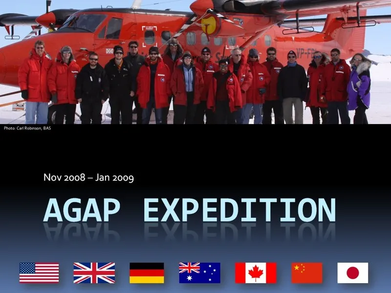
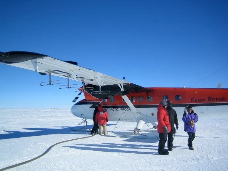
The crux of the airborne operation were two de Havilland Canada DHC-6 Twin Otter Aircraft, piloted by Kenn Borek Air Ltd. The aircraft belong to the British Antarctic Survey and the United States Antarctic Program. Each aircraft was outfitted with geophysical sensors.

This Synthetic Aperture Radar (SAR) images the ice from top-to-bottom. SAR measures ice thickness, potential internal structure of the ice sheet, ice surface elevation, and also images the ice-bedrock interface. The ultra-wideband radar allowed all of these measurements to be made simultaneously. The SAR data helped determine ice thickness, internal ice movement, and helped in characterizing the surfaces below the ice sheet. These techniques were new at the advent of the AGAP-GAMBIT Project, and gave way to figuring out how wet the bottom of the ice sheet was and where water might flow or collect into subglacial lakes.
")
Magnetometers detect the magnetic properties of the rocks in the Earth’s crust,which have a distinct magnetic signature. This distinct signature relates to their composition, structure, and date of deposition. By equipping a magnetometer in the suite of airborne geophysical sensors, the AGAP-GAMBIT Project was able to collect ground breaking information about the bedrock beneath ‘Dome A’, and the Gamburtsev Mountains.
")
In Antarctica, gravimeters are used to map and interpret geology that is beneath the ice sheets. Where radar has difficulty seeing through subglacial lakes, gravimeters can detect the depth of subglacial lakes and other sub-ice geologic features. This led to a new and improved bathymetric map of the ‘Dome A’ area in East Antarctica.
")
The suite of airborne geophysical sensors was equipped with a Light Detection And Ranging (LiDAR) instrument. The laser altimeter was fixed to the aircraft and scanned the surface of the ice sheet during survey flights. The LiDAR data was essential to understanding the surface elevation and topography of the ‘Dome A’ area of East Antarctica. Any indication of snow and ice loss would be a sign of climate change - as the continental ice sheet requires a steady mass-balance.
Acknowledgements
Federal funding for these activities were provided by the National Science Foundation under Antarctic Research Grants: ANT 0632292, and ANT 0619457.
Any opinions, findings, and conclusions or recommendations expressed in this material are those of the author(s) and do not necessarily reflect the views of the National Science Foundation, British Antarctic Survey, Australian Antarctic Division, GAMSEIS Project, or the International Polar Year Initiative.